IMAGING SCIENCE · REMOTE SENSING · AI

Sagar
Lekhak.

Sensing for a safer world.

I study how drones, imaging sensors, and artificial intelligence can help us find landmines—and turn complex measurements into useful evidence.

PhD student, Imaging Science
Rochester Institute of Technology

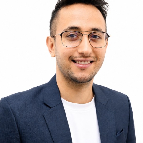
Sagar Lekhak
RESEARCH WITH PURPOSE

From pixels and spectra
to real-world impact.

UAV SENSING / HYPERSPECTRAL IMAGING / MACHINE LEARNINGSCROLL TO EXPLORE

A researcher.
An engineer.
A science communicator.

My RIT profile ↗

Better sensing.
Meaningful impact.

I’m an Imaging Science PhD student at RIT, working at the intersection of remote sensing, computer vision, and humanitarian technology.

Advised by Prof. Emmett J. Ientilucci in the Digital Imaging and Remote Sensing Laboratory, I investigate how complementary sensors and learning methods can improve surface-landmine detection. My work connects field experiments, calibrated imagery, open datasets, and careful evaluation. My broader interests include physics-informed sensor fusion and adaptive sensing for surface and buried explosive hazards.

Originally from Nepal, I bring a background in electronics and communication engineering and a master’s in Imaging Science. I also contribute to research on LiDAR, imaging spectroscopy, and vegetation structure. I care about building research that others can use—and explaining why it matters beyond the lab.

BASED INRochester, New York
RESEARCH HOMERIT · DIRS Laboratory
FOCUSHumanitarian sensing
From the field
to the algorithm.

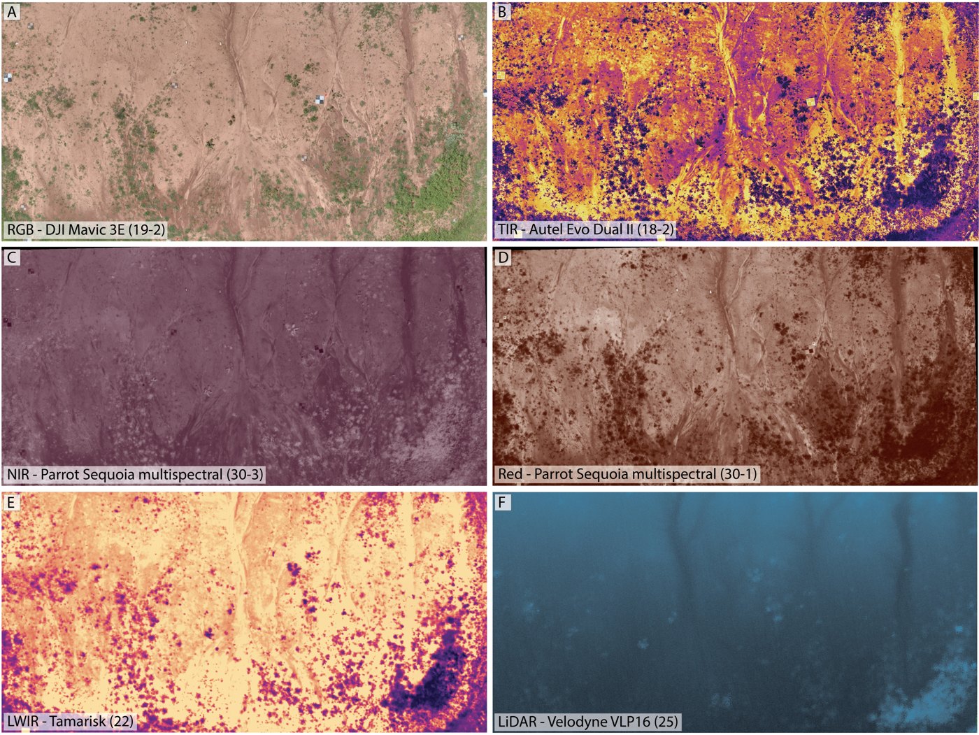
Different sensors reveal different things.
I study how to make that information reliable, complementary, and useful.

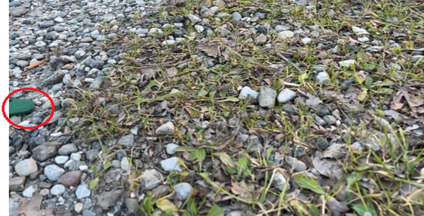
Surface imagery from the SULAND research used to study landmine object detection
02 — COMPUTER VISION & AI

Detection you can interrogate.

Reliable labels, uncertainty estimates, and evaluation under domain shift are essential to understanding a detector. I develop and assess RGB detection methods through SULAND_v2, benchmarking, and domain adaptation.

Object detectionUncertaintyDomain adaptation
Explore SULAND_v2 ↗
03 — HYPERSPECTRAL IMAGING

More than meets the eye.

Spectral measurements offer material information beyond an RGB image. I study statistical and learned detectors, target-signature selection, and the inspection effort required to recover small targets.

Spectral detectionHuman in the loopOpen benchmarks
Read the signature-bootstrapping paper ↗
RELATED RESEARCH — ENVIRONMENTAL REMOTE SENSING

From explosive hazards to vegetation structure.

Collaborative work extends to full-waveform LiDAR signal deconvolution for leaf area index modeling, and UAS-guided harmonization of airborne imaging spectroscopy for shrubland monitoring.

Field imagery: collaborative DRC research and SULAND_v2 studies. The spectral cube is a conceptual illustration.

Research,
in writing.

Download BibTeX

Published, accepted, submitted, and in-preparation work is labeled separately. Publication status updated November 2026.

Good science
deserves a
clear voice.

I enjoy making technical research accessible to audiences beyond my own field. Research and communication are both part of that work.

2026
IEEE GRSS · IGARSS

First Prize & People’s Choice

Excellence in Technical Communication Student Prize

Recognition ↗
2026
IEEE ROCHESTER JOINT CHAPTERS MEETING

Outstanding Innovation and Research Award

Recognition for presenting UAV multisensor benchmarking and AI fusion research for humanitarian demining.

2026
STRATUS

Best Student Oral Presentation

Also received the CRC Press / Taylor & Francis Best Student Presentation Award.

Award announcement ↗
2025
ROCHESTER INSTITUTE OF TECHNOLOGY

First Place · Three Minute Thesis

“No More Deadly Butterflies: Drone and AI Against Landmines”

RIT winners ↗
2025
IEEE GRSS · IGARSS

Second Prize · Technical Communication

International 3MT-style research communication competition, Brisbane.

2024
RIT · RESEARCH SUPPORT

Steven M. Wear Endowed Fund Award

Support for research and conference participation.

2022
ERASMUS+

KA107 Mobility Traineeship

Universidad Politécnica de Cartagena, Spain.

Built to be
built upon.

Open data, code, and teaching material
for the next experiment.

A little more
about the journey.

Education

PhD · Imaging Science

Rochester Institute of Technology

Advisor: Emmett J. Ientilucci

MS · Imaging Science

Rochester Institute of Technology

GPA: 3.96/4.00 · College of Science Graduate Delegate, 2026; selected to deliver commencement remarks.

BE · Electronics & Communication Engineering

Tribhuvan University, Nepal

Teaching & service

Making technical ideas approachable

Teaching support in Radiometry, Human Vision System, and Linear and Fourier Methods for Imaging. Mentoring in Python and machine learning through RIT’s Coding Resource Center.

Community and professional leadership

Service includes Vice Chair of the IEEE GRSS Western New York Chapter and President of RIT’s Nepalese Students Association.

Licensed engineer, Nepal Engineering Council, since 2023.

Peer review

Reviewer for IEEE Transactions on Geoscience and Remote Sensing, IEEE Journal of Selected Topics in Applied Earth Observations and Remote Sensing, and IEEE InGARSS 2025.

Field collaboration

Research with the Demining Research Community and coordination of the ROCX 2025 landmine experiment.

Across disciplines.
Across borders.

Python · PyTorch · scikit-learn · OpenCV · ENVI · QGIS · DIRSIG · Git · Linux

Science is also
a conversation.

Preparing for 3MT: Tips, Suggestions, and Lessons from My Journey

What I learned about turning a technical research story into three minutes that connect with an audience.

Read the article ↗

LET’S CONNECT

Interesting questions.
Shared possibilities.

I welcome conversations about remote sensing, imaging, machine learning, and research with humanitarian impact.

sl3088@rit.edu